Murrumbidgee River

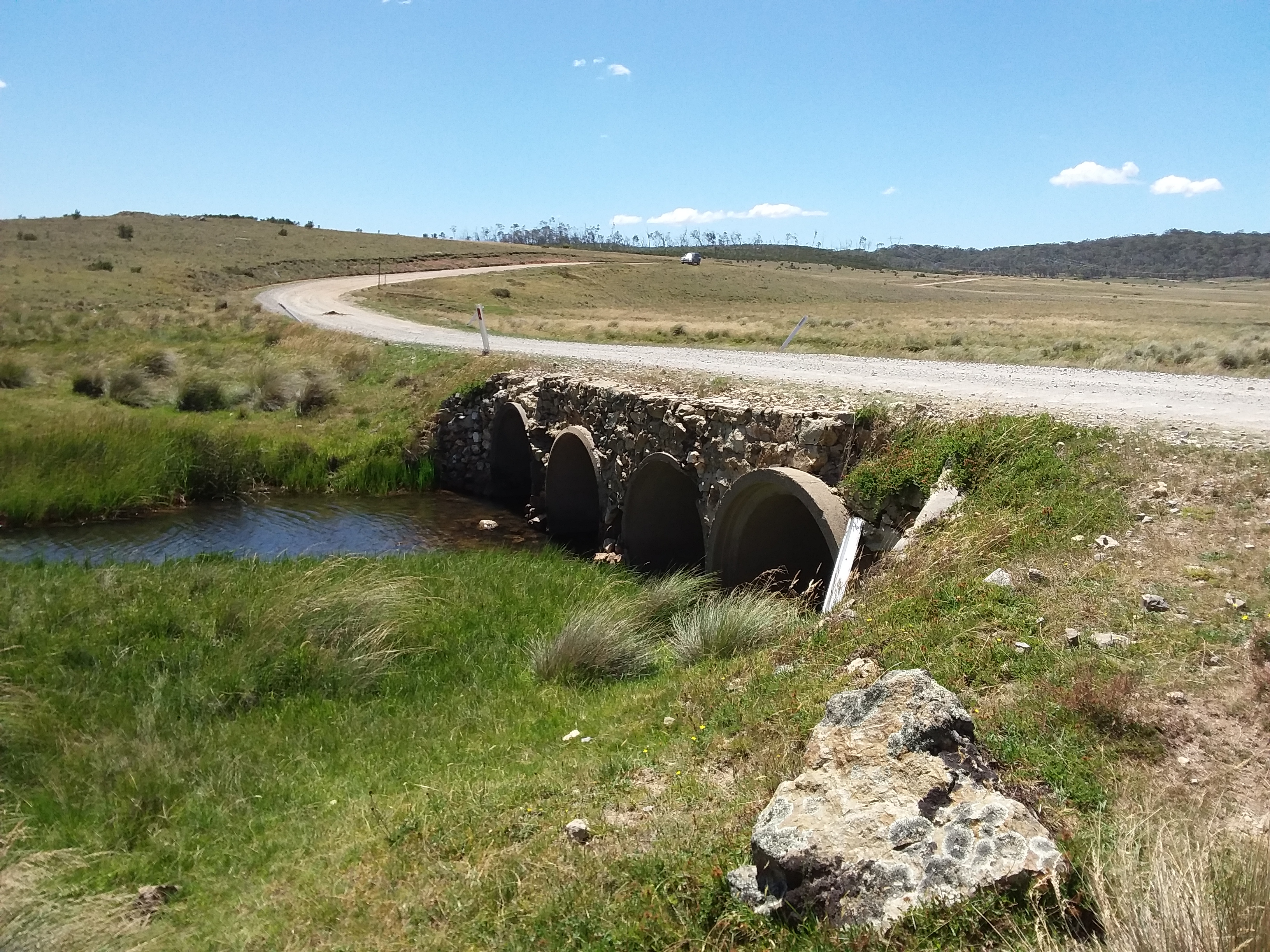
Not far from where it arises, the Murrumbidgee River can be viewed from Long Plain Road in Long Plain, New South Wales.
Although a defined administrative area, Long Plain is located entirely within the Kosciuszko National Park.
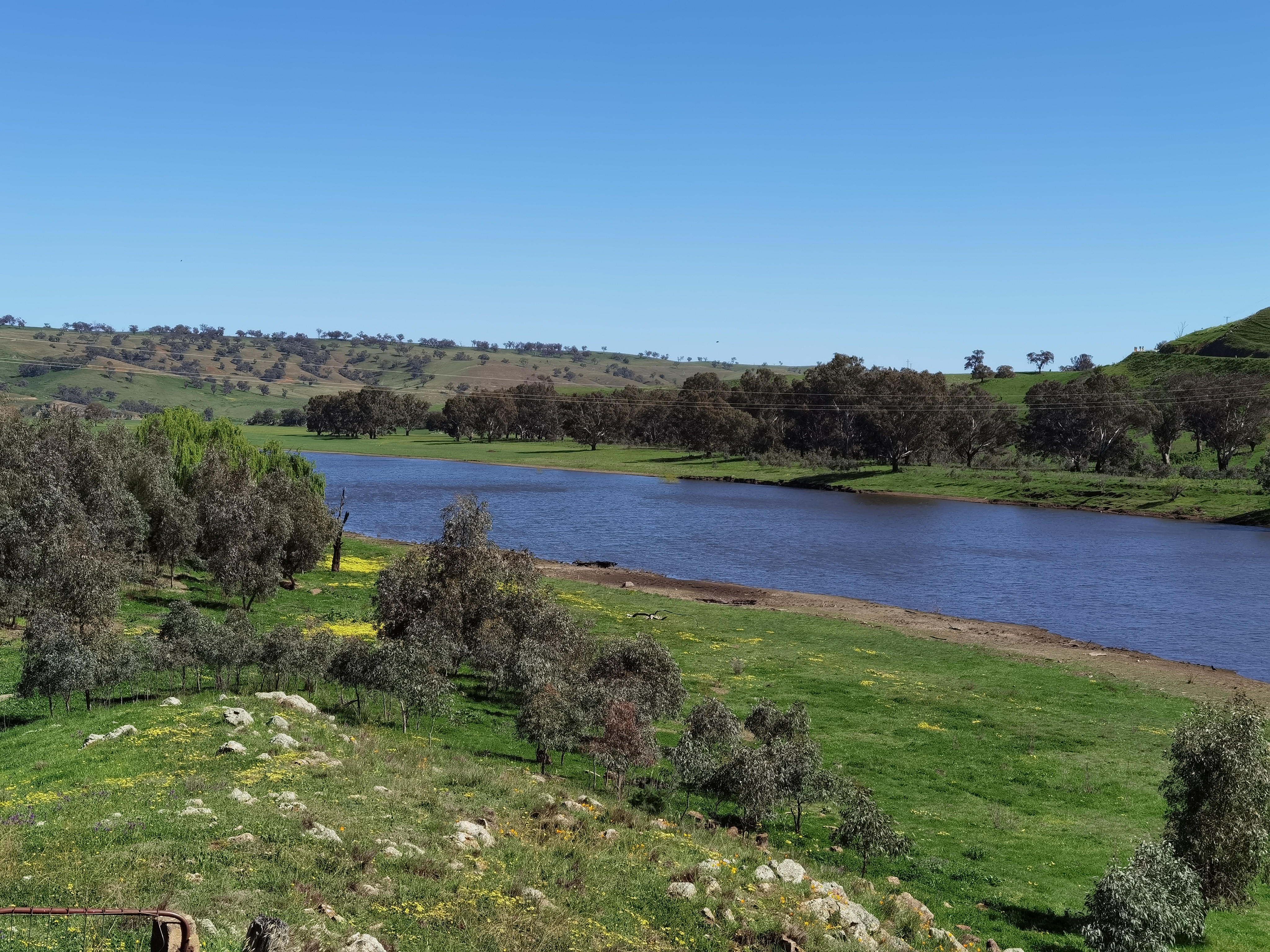
Taemas Bridge is a heritage-listed bridge by which the Wee jasper Road crosses the Murrumbidgee River between Boambolo and Cavan,
in New South Wales, south of Yass. This photograph shows the river viewed from the Cavan end of the bridge. This section of river
is the upper reach of water held back by the the Burrinjuck Dam.
The Murrumbidgee is the second longest river in Australia. Initially flowing south-east from the Snowy Mountains region of New South Wales, the river turns north and then west, eventually joining the Murray River.
Much more information and many more images can be found at Wikipedia.
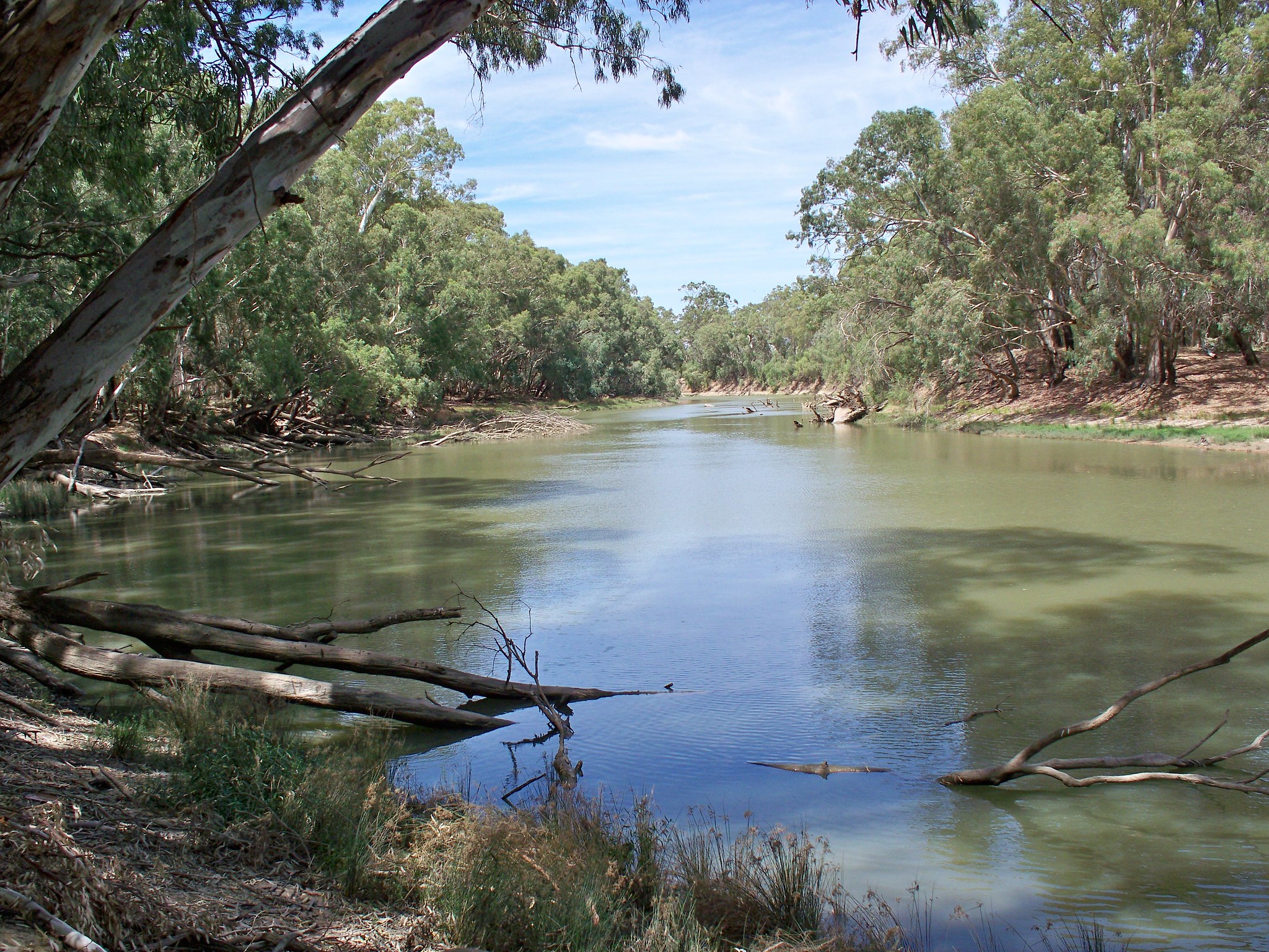
This image shows the Murrumbidgee Rive 5km east of Hay, New South Wales, at Sturt's Marked Tree. Charles Sturt was an early colonial
explorer who mapped part of the Murrumbidgee as well as other extensive areas of south-east Australia after European settlement.
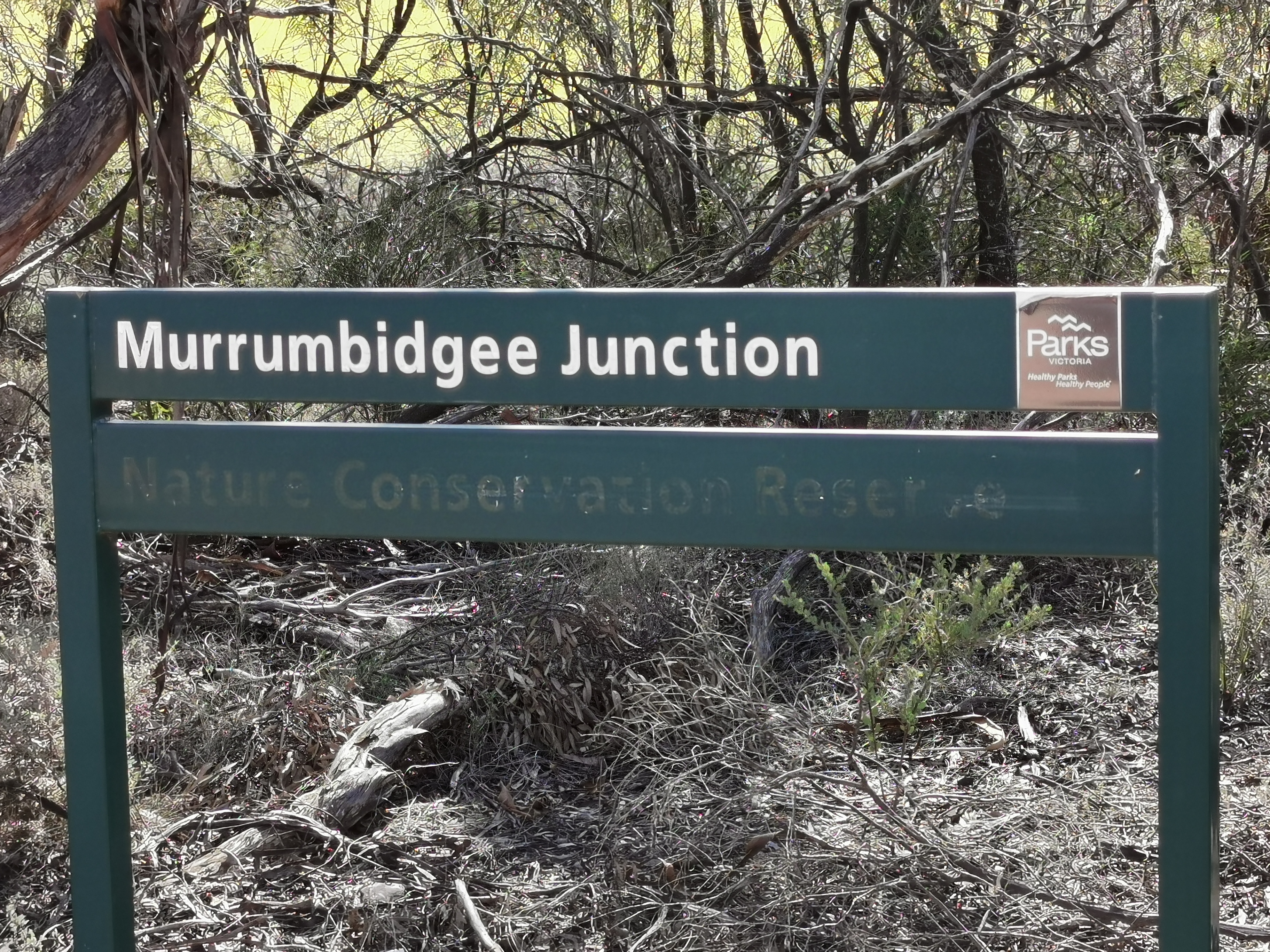
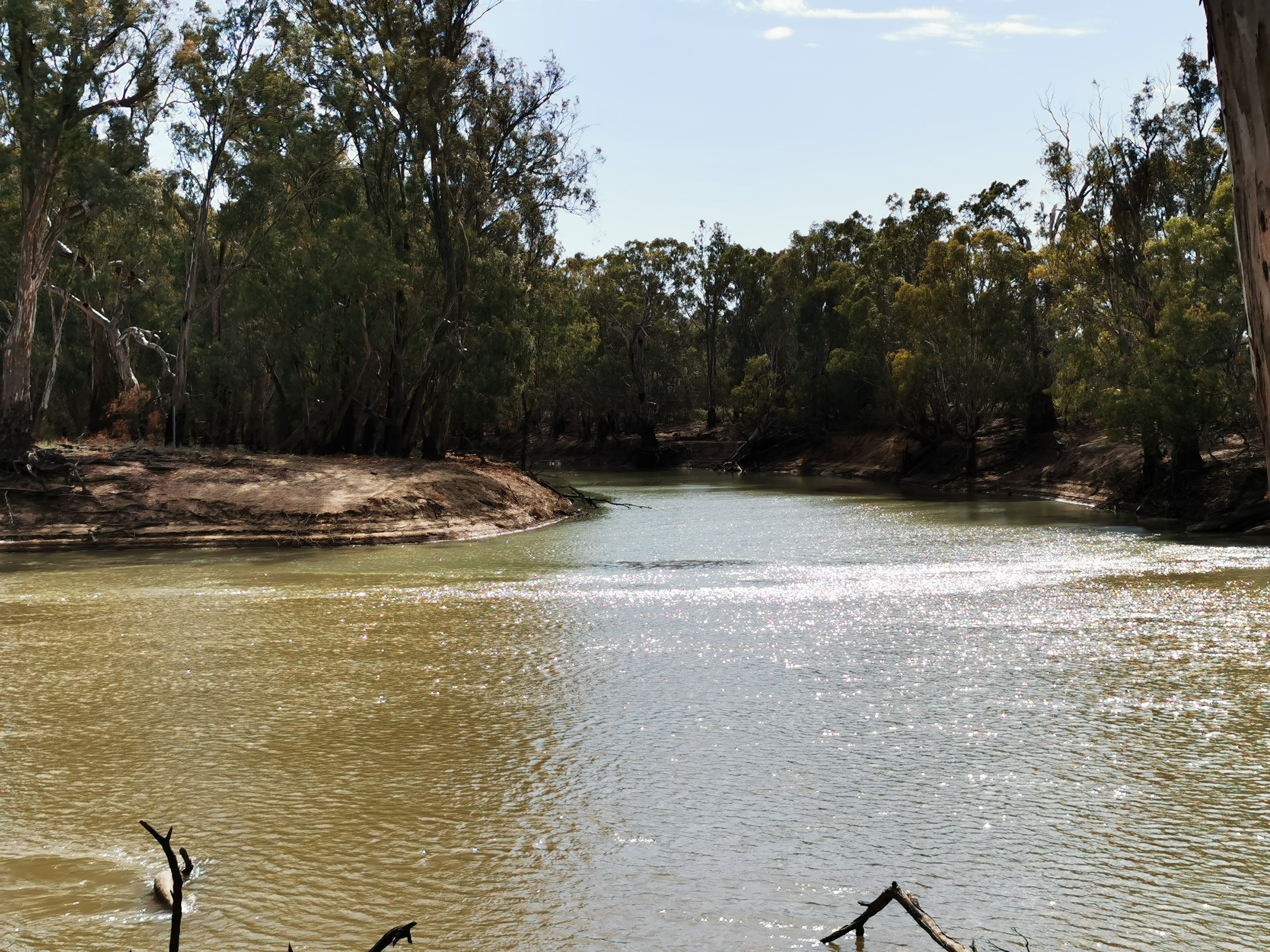
The Murrumbidgee River joins the Murray River at Murrumbidgee Junction. Although the
Murrumbidgee River flows entirely within New South Wales and the Australian Capital Territory, the Murrumbidgee Junction can be
viewed only from across the state border at Boundary Bend in Victoria. Sturt's description of his party's passage through the junction of the
Murrumbidgee and Murray Rivers was dramatic. His description of wild strong currents in the Murrumbidgee — in the middle of summer
(14 January 1830), when flows are declining and close to the seasonal summer/autumn minimum, are in contrast to the sluggish,
chronically irrigation-reduced flow seen at the junction today in mid-summer. See more at
Wikipedia.
Murrumbidgee Wetlands
The Murrumbidgee River is a major source of water for an extensive system of wetlands and floodplains, particularly in the lower parts of the river system. The river is a major conduit by which water from the Snowy Mountains supports major wetlands in south-western New South Wales.
The main wetlands and wetland systems that receive water from the Murrumbidgee River are:
- Gayini (Nimmie-Caira): A significant area (over 87,000 ha) of cultural and environmental importance to the Nari Nari people, featuring extensive River Red Gum, Black Box, and Lignum wetlands, and critical waterbird rookeries like the Bala and Kieeta Lake rookeries.
- Redbank Wetlands: A mosaic of River Red Gum forest and woodland, including spike rush wetlands. It is often divided into North and South management subzones.
- The Western Lakes: Open quaternary lakes west of the Lower Murrumbidgee floodplain.
- Yanga National Park: A conservation area that protects a large part of the Murrumbidgee floodplain and its wetlands.
The Lower Murrumbidgee Floodplain
This is the most extensive and ecologically significant wetland area in the Murrumbidgee valley, covering approximately 200,000 hectares. Located between Maude and Balranald, it is essential for colonial waterbird breeding and is home to one of Australia's largest River Red Gum forests. The name "Lower Murrumbidgee" is sometimes abbreviated to the unofficial name "Lowbidgee" but this abbreviated name is not officially recognised by the New South Wales Geographic Names Board. Key areas within the Lower Murrumbidgee Floodplain include:- Pimpara–Waugorah: A mosaic of creek lines, paleochannels, and wetlands.
The Mid-Murrumbidgee River Wetlands
This system is an assemblage of lagoons, billabongs, and River Red Gum forest located on the central Murrumbidgee floodplain, generally between Wagga Wagga and Carrathool. They consist of hundreds of riverine lagoons and oxbow billabongs, which are often remnants of a palaeo (old) river system. These wetlands are critical as drought refuges for various species, including native fish, frogs, and turtles, as they often retain water when other temporary wetlands dry out.- Fivebough and Tuckerbil Swamps: These wetlands, located near Leeton, are internationally recognised and are listed under the Ramsar Convention (wetlands of international importance). They provide significant habitat, especially for migratory waterbirds.
- Other specific lagoons and swamps in this area also receive water, sometimes via pumping or dedicated environmental releases, such as Yarradda Lagoon and Sunshower Lagoon.
Murrumbidgee Irrigation Area (MIA) Wetlands
These are important wetlands that may receive water via the Murrumbidgee River, often managed in connection with the irrigation system.Yanco-Billabong Creek System
This system, including creeks and associated wetlands like Wanganella Swamp and the Mainie Swamp, is fed by the Murrumbidgee River via off-takes like the Yanco Creek Regulator. It forms part of the network of effluent streams and wetlands that are hydrologically linked to the main river.Sources
- Murrumbidgeee River sign near Long Plain Road is published under CC0 - No Rights Reserved. This picture may be freely reproduced. If you wish, you may attribute 97k.com as the source.
- Murrumbidgeee River near Long Plain Road is published under CC0 - No Rights Reserved. This picture may be freely reproduced. If you wish, you may attribute 97k.com as the source.
- Murrumbidgeee River viewed from Taemas Bridge is from Flickr and is available under CC0 - No Rights Reserved
- The map of the Murrumbidgee River © OpenStreetMap contributors.
- The image of the Murrumbidgee River 5km east of Hay is by Kevin Matthews at Flickr licensed under CC BY-NC-ND 2.0.
- Murrumbidgeee Junction Nature Conservation Reserve sign at Boundary Bend, Victoria, is published under CC0 - No Rights Reserved. This picture may be freely reproduced. If you wish, you may attribute 97k.com as the source.
- The image of the Murrumbidgee River joining the Murray River is from Flickr and is available under CC0 - No Rights Reserved
- The text for the section "Murrumbidgee Wetlands" was initially drafted by Google Gemini and then modified slightly.
The three lines symbol at the top of the page permits users to toggle the menu on/off.