Lachlan River

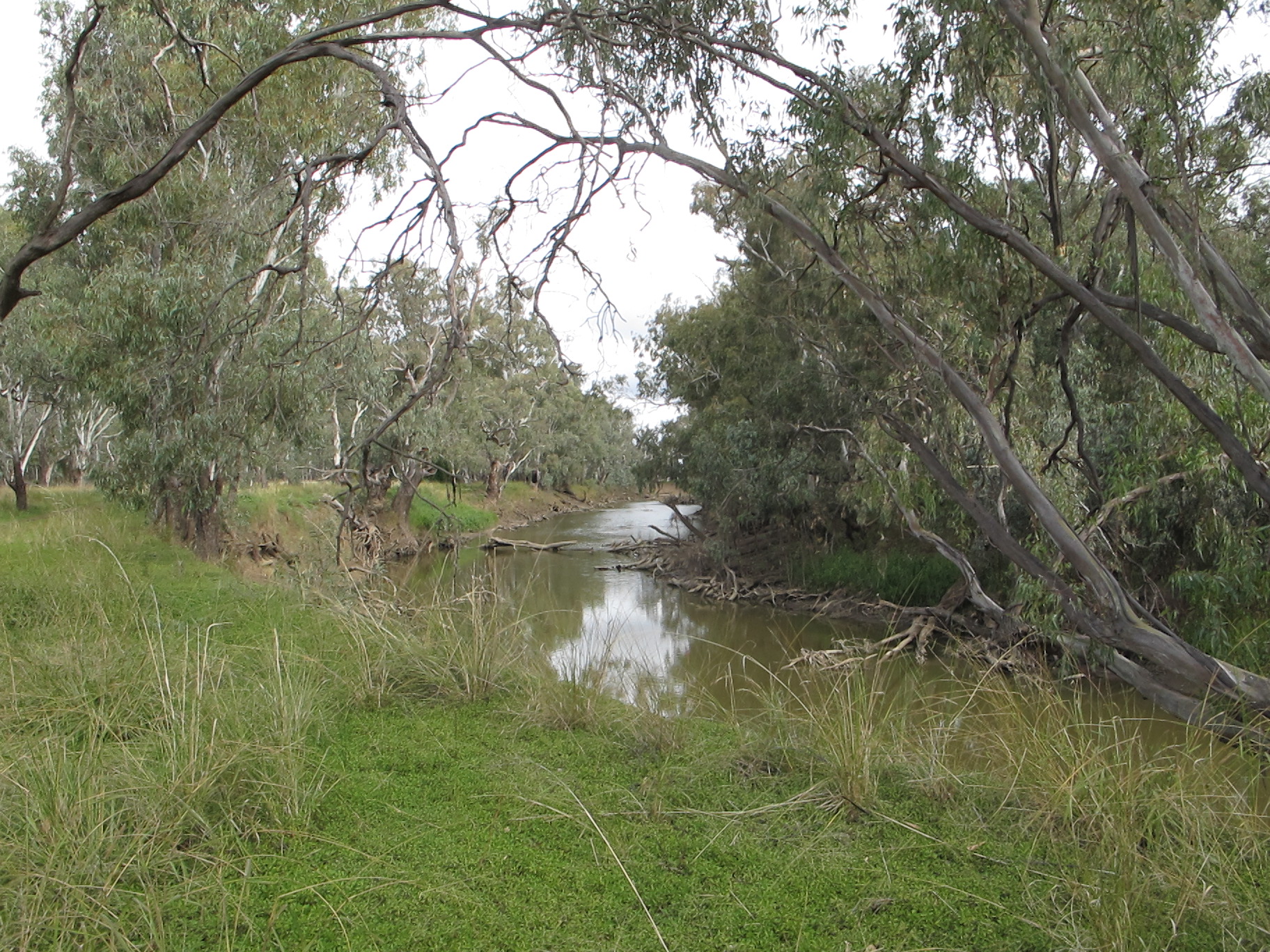
Lachlan River, near where it starts, viewed from the Sydney-Melbourne railway line at
Cullerin NSW, near the town of Gunning.
The Lachlan River supports the largest areas of wetlands in New South Wales. Many years ago, the downstream water flowed along the waterway that is now known as Willandra Creek. About 15,000 to 20,000 years ago, there was a significant geological event in south-east Australia - it changed the courses of rivers including the Murray River and Lachlan River. Since that event, the majority of water in the Lachlan has followed its current course, spilling out in many places across the wide flat land, creating multiple distributary streams and wetlands. The lakes that the water formerly filled became dry and are now known as the Willandra Lakes area, with the best known being Lake Mungo. When filled with water, the lakes supported large communities of indigenous people but, since the course of the Lachlan was changed, the landscape has also changed significantly.
Starting in the east, the Lachlan River is fed by numerous tributaries, which are crucial for its water supply, particularly in the upper and middle sections. The most notable ones are located on the western slopes of the Great Dividing Range. The main tributaries include:
- Abercrombie River: Rising west of the Great Dividing Range, about 40 kilometres (as the crow flies) west of Lake Burragorang (water supply for Sydney) or 60 kilometres west of Picton. It is a significant tributary of the Lachlan River.
- Boorowa River: This river flows into the Lachlan, contributing to the overall water system.
- Belubula River: Rising in the Central Tablelands, the Belubula is regulated by the Carcoar Dam and is a key contributor to the Lachlan's flow.
- Crookwell River: Another major tributary that adds to the flow of the Lachlan in its upper catchment.
- Mandagery Creek: This creek rises near Molong and passes through Eugowra and is an important tributary in the middle part of the catchment.
These tributaries are vital for the river system's health, as they bring in nutrients and water, especially during rainfall events. The Murray-Darling Basin Authority (MDBA) and the NSW Department of Planning, Industry and Environment (DPIE) are authoritative sources that provide detailed information on the water flows and health of these tributary systems.
Lachlan River, viewed from North Forbes Road at Condobolin, New South Wales.
In contrast to its tributaries, the Lachlan River also has a number of distributaries and anabranches, particularly in its lower, flatter areas. These channels divert water away from the main river. The lower Lachlan River is known for its complex system of anabranches, effluent streams, lagoons, and wetlands, including:
- Lake Cowal
- Lake Cargelligo
- Lake Brewster
- Willandra Creek: A significant distributary that carries water away from the main river, particularly during high-flow events.
- Merrowie Creek and Moolbang Creek: These are effluent streams that also divert water from the river to wetlands.
- Great Cumbung Swamp: This is the terminal point of the Lachlan River system. It's a vast, 500 square kilometre swamp where the Lachlan's flow terminates. Only during major flood events does water from the Lachlan's system make it through the swamp to connect with the Murrumbidgee River.
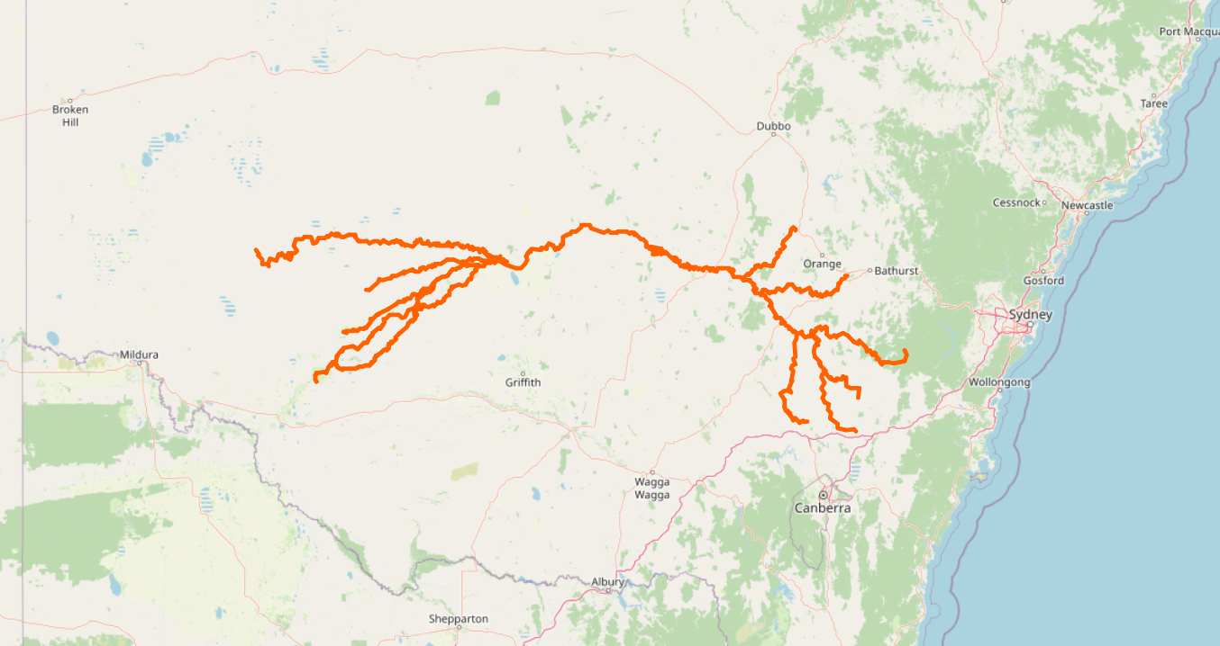
Map of Lachlan River with its major tributaries and distributaries. Water flows from higher
altitudes in the south-east of New South Wales towards the low flat land in the south-west.
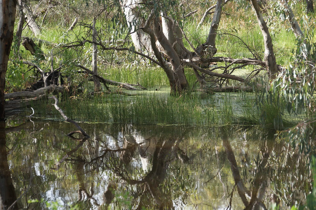 >
>Reflections in the Lachlan River at Oxley, New South Wales.
Sources
- Lachlan River, near where it starts, viewed from the Sydney-Melbourne railway line at Cullerin NSW, near the town of Gunning is published under CC0 - No Rights Reserved. This picture may be freely reproduced. If you wish, you may attribute 97k.com as the source. It is also published at Flickr.com
- Lachlan River, viewed from North Forbes Road at Condobolin, New South Wales is published under CC0 - No Rights Reserved. This picture may be freely reproduced. If you wish, you may attribute 97k.com as the source.
- Map of Lachlan River with its major tributaries and distributaries is from OpenStreetMap and is available under Open Data Commons Open Database License (ODbL)
- Reflections in the Lachlan River at Oxley, New South Wales is from Flickr and is available under CC0 - No Rights Reserved